Dramatic lightning maps from the Met Office show that more storms are expected on Friday after a morning of intense thunderstorms across the North East. The maps reveal hundreds of lightning strikes in just one hour, causing power cuts and school closures.
Morning Storms Cause Havoc
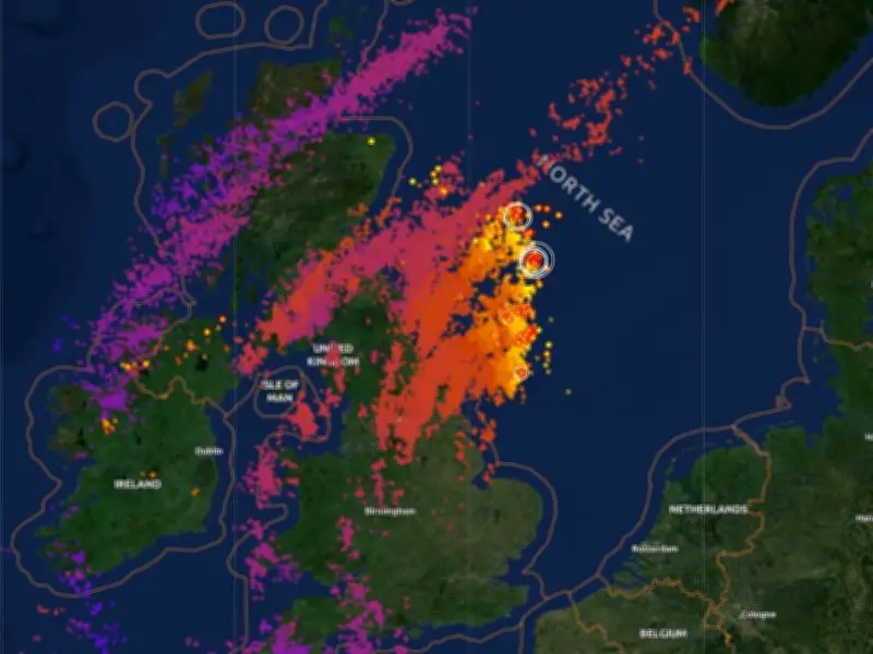
Thunderstorms woke up the North East this morning, with lightning maps from the Met Office showing the strikes moving through the region and out to sea. South Tyneside was less affected than areas further north, but hundreds of strikes still impacted the area in just one hour. The strikes caused power cuts in some areas and forced the closure of a school in Wallsend after a lightning strike.
The map from around 8am shows red dots for older strikes and lighter colours for strikes occurring at that time, as people prepared for school and work.

Yellow Weather Warning in Place
Another yellow weather warning is in place from 2pm until 9pm on Friday. The Met Office states: "Whilst most places will miss them, scattered thunderstorms may break out this afternoon and early evening. Where storms do occur, heavy rain, large hail, gusty winds and frequent lightning are all possible with 15 to 30 mm rain falling in a short space of time in a few places."
Why Thunderstorms Develop
Thunderstorms are a common side effect of warm weather. According to the Met Office, thunderstorms are most likely when the atmosphere becomes unstable, typically when very warm air near the surface sits beneath much cooler air higher up. During hot and humid weather, especially after several days of strong sunshine, the atmosphere becomes unstable. The heat increases energy levels in the air, and as warm air rises, it cools and condenses, forming large cumulonimbus clouds. These clouds can grow quickly and produce heavy rainfall and thunderstorms.
Within these clouds, powerful updrafts and downdrafts create a turbulent environment. Water droplets, ice crystals, and hailstones collide, generating electrical charges. Over time, this accumulation of charge becomes strong enough to be released as a sudden electrical discharge known as lightning. The flash of lightning heats the surrounding air extremely quickly, causing it to expand rapidly and create a shock wave, which we hear as thunder.