Many parts of the UK will get some long-awaited showers this week after several brutal heatwaves brought with them a dryness that has resulted in widespread droughts. Hosepipe bans remain in place in areas such as London and parts of Wales, and locals in many regions have noticed scorched grass in their nearby parks, a far cry from the greenery they are used to seeing.
Rain expected from Saturday
The UK has had a staggering five heatwaves so far this summer, with a sixth expected to arrive in a matter of weeks. However, some temporary relief is on the way as the latest weather maps from WXCharts and the Met Office show rain arriving in many parts of the country, along with temperatures much lower than those of the last few weeks.
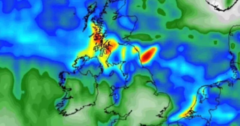
Rain is expected to arrive in parts of England, Scotland, and Wales by midnight on Saturday, August 22, WXCharts' current maps show. Meanwhile, heavier rain is expected in the following week and for the rest of the month, marking a drastic change to the conditions the UK has faced since May of this year.
Areas affected
According to WXCharts, the UK areas that will see rain this week are:
England: Northumberland, Cumbria, Tyne & Wear, Lancashire, North Yorkshire, West Yorkshire, East Riding of Yorkshire, Greater Manchester, Merseyside.
Scotland: Orkney, Caithness, Sutherland, Ross and Cromarty, Inverness-shire, Nairnshire, Moray (Elginshire), Banffshire, Aberdeenshire, Kincardineshire, Perthshire, Angus (Forfarshire), Argyll, Fife, Clackmannanshire, Kinross-shire, Stirlingshire, Dunbartonshire, Bute (Buteshire), Renfrewshire, Lanarkshire, West Lothian (Linlithgowshire), Midlothian (Edinburghshire), East Lothian (Haddingtonshire), Ayrshire, Peeblesshire, Selkirkshire, Berwickshire, Roxburghshire, Dumfriesshire, Kirkcudbrightshire, Wigtownshire.
Wales: Isle of Anglesey, Gsynedd, Conway.
Met Office forecast
From Saturday, August 22, the Met Office says that there will be a dry start, but a few showers are likely in the far north and possibly the far southeast.
"Conditions look like turning increasingly unsettled through next week, as low pressure gradually becomes dominant, squeezing the ridge off to the northeast and southwest," the Met Office's current forecast for this weekend and the following days reads. "Most places are likely to see some rain or showers, which may be heavy with a risk of thunder at times. It may become breezy if not windy at times, too. Temperatures are likely to be near or a little below normal overall, with some chilly nights at first, but brief warm, humid spells are possible at times, especially in the south."
Meanwhile, Met Office maps currently show small patches of rain moving over the UK from today and into the weekend, with light showers expected. On WXCharts, maps currently show a significant drop in temperatures as well.
Social media warning
The Met Office has taken to social media to warn Brits of rain ahead. In an Instagram post, the weather service shared a map of the UK showing rain moving through the country.
"It’s a changeable week ahead with rain in the forecast but how much rain will your local area experience this week?" it said. "Many places that have largely missed out on rain recently are likely to see some wet weather this week. Expect outbreaks of rain, with a risk of thunder and some intense downpours mixed in."