The sunny conditions across much of the UK are expected to give way to a more unsettled spell next week, with the Met Office warning of heavy rain and possible thunderstorms.
Early provisional Met Office statistics show both England and Wales are on course to record their driest July in 190 years. Several counties in England saw less than 1mm of rainfall last month, and more than half of England and the entirety of Wales are officially in drought.
The Met Office described July as “a exceptional combination of extreme heat, abundant sunshine and an almost complete absence of rainfall in some areas”.
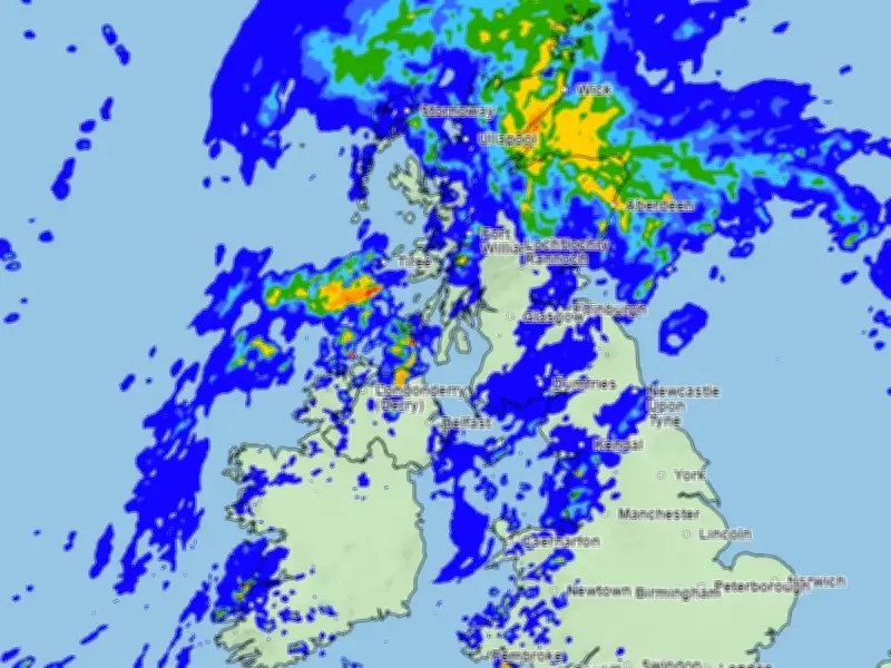
Conditions have remained largely sunny this week in Liverpool and elsewhere in the UK, bar a few hours of rainfall. From Monday, the Met Office says an area of low pressure will extend across the UK from the south west, bringing a spell of potentially heavy rain to parts of the north with showers in the south. Warmer and more humid air will also return across England and Wales, with 30C likely to be exceeded again for some, and some areas could experience thunderstorms.
Forecaster: change in weather type
Met Office Chief Forecaster Chris Bulmer said: “A change in weather type early next week will see warmer conditions return across England and Wales but in contrast to much of the summer, this will be associated with showers or perhaps thunderstorms for some places. However, some parts of the south will only see small amounts of rain. It will stay cooler in the north with the potential for heavy rain to build up, especially over parts of Scotland.”
No official weather warning for rain or thunderstorms is in place at this time.
Heat alerts remain
Meanwhile, the UK Health Security Agency has heat alerts in place for several areas of England from 9am today, Sunday August 2, until Wednesday August 5 at 9am. These areas are: East Midlands, West Midlands, East of England, London, South East and South West.
The alert means minor impacts are likely across health and social care services, including increased use of healthcare services by vulnerable people, greater risk to life of vulnerable people, increased potential for indoor environments to become very warm and water-related incidents may increase, including risks from cold-water shock and drowning.
Liverpool forecast
Liverpool is not forecast to experience thunderstorms at this stage. Temperatures are expected to reach a high of 25C during the afternoon. Tomorrow will also see spells of sunshine and clouds until a prolonged spell of rain from 4pm, which could last through the night and into Tuesday afternoon, with temperatures between 17C and 29C. There will be spells of clouds and sunshine throughout most of the day, with a 30% chance at 6pm.
The Met Office forecast for the North West of England said:
“Today: A warm, dry and bright day with plenty of sunny spells and light winds. Clouding over in the evening perhaps with some outbreaks of rain. Slightly warmer than Saturday. Maximum temperature 22C. Tonight: Turning increasingly cloudy from the west during the evening with outbreaks of rain pushing across the region during the early hours. Minimum temperature 12C.
“Monday: Turning very warm and humid on Monday with an increasing chance of showers. These potentially thundery at times. Maximum temperature 26C.
“Outlook for Tuesday to Thursday: Rather changeable with sunny spells and showers, these potentially heavy and thundery on Tuesday. Turning somewhat drier from Wednesday, with temperatures returning to average.”