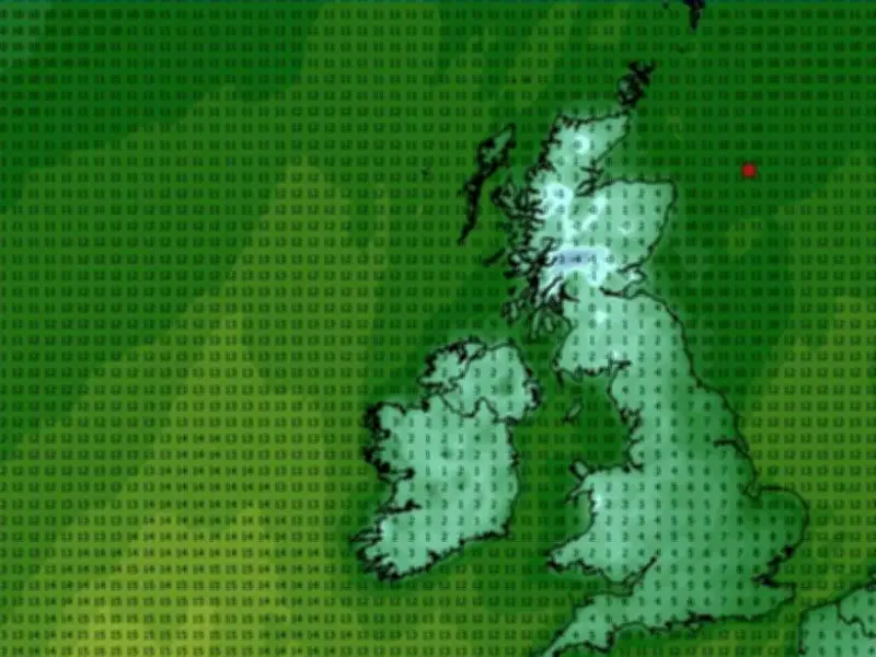
Britain is set for a dramatic cold snap within days, with temperatures forecast to plummet as low as -4C. Maps produced on Wednesday by WXCharts reveal the coldest areas will be concentrated in the north of the country, though single-figure temperatures are expected nationwide.
Higher ground in the west of Scotland could experience -1C to -4C at midday on Sunday, with 0C to 1C across the wider region. Elsewhere, the thermometer in England, Wales and Northern Ireland will range from 1C in south Wales to 6C in Southampton, 9C in Norwich, 5C in Manchester and 8C in Newcastle.
Sharp contrast to recent mild spell
This is a huge difference to the 21.8C recorded in Teddington in southwest London, and the 20.3C recorded in Pershore, Worcestershire on Tuesday afternoon. It was a balmy 19.6C as far north as Bridlington, East Yorkshire.
According to WX Charts, the areas most likely to face freezing conditions this weekend include the Highlands, Na h-Eileanan-Siar, Argyll and Bute, Stirling, Perth and Kinross, Inverclyde, Lanarkshire, Renfrewshire, Ayrshire and Dumfries and Galloway. The coldest spot on Sunday at midday is expected to be around Argyll and Bute and the Highlands.
Forecasters warn of chillier conditions
Snow, though, is unlikely. The heaviest of any rain, forecast for Sunday, will be across the East of England and parts of the Southeast of England.
Met Office meteorologist Honor Criswick explained that high pressure will bring dry, settled conditions over the weekend, with isolated patches of rain and showers pushing in from the north. She warned it will feel considerably chillier than the recent mild spell the country has been enjoying this week.
The forecaster's five-day outlook confirms it will be "much cooler" than of late come the weekend, with a handful of showers possible across the far north and south. BBC Weather's Darren Bett said a belt of rain and cloud will shift eastwards overnight into Friday, with colder air from the north moving southwards.
Weekend outlook
Mr Bett added it would be considerably cooler across the entire UK this weekend, with temperatures notably lower than those experienced recently. The forecaster anticipates dry and settled conditions on Saturday thanks to high pressure. Showers could drift into the south-east on Sunday while cloud and light rain push into the north-west, according to BBC Weather.
According to the Met Office UK five day weather forecast for Wednesday, October 14 to Sunday, October 18, today will be blustery across the north and particularly in north-west Scotland which will experience severe gales. Most areas will be dry and bright, with the finest sunshine in the south. Cloud will build in the north-west, bringing patchy rain across Scotland. Tonight will bring heavy rain and brisk winds spreading south-eastwards across Scotland and Northern Ireland, followed by clear spells and showers. Much of England and Wales will remain dry, with variable cloud.