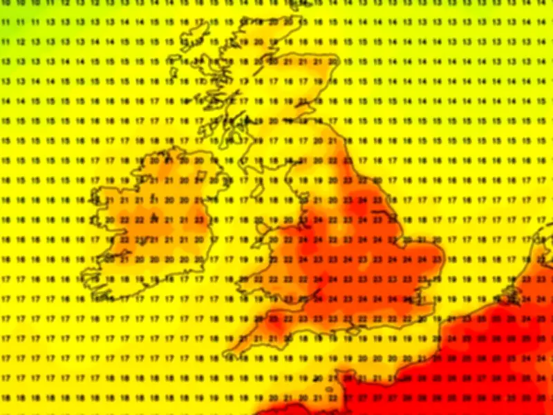
Britain could be in for an October scorcher, with fresh weather maps turning deep orange as temperatures soar to a balmy 25C. The most recent charts indicate a burst of unseasonably warm weather spreading across vast areas of the nation on October 6, with 21 counties and regions predicted to see highs of 23C. The hottest regions are poised to be those across the Southeast of England and East of England, forecasters say.
Warm end to September
It follows a warm end to September with 22.8C recorded on Saturday at Kew Gardens, southwest London and 22.1C noted in Cavendish, Suffolk. Temperatures are set to climb further, though, with 25C anticipated on or around October 6. Typically, the mercury struggles to exceed 17C in an average October, even across London and the Southeast of England.
The Met Office described Friday as "exceptionally warm for late September" but rain swept eastwards throughout the weekend, heaviest over the Scottish Highlands on Saturday and parts of Cumbria and Lancashire today.
Long-term forecast
Yet the long-term picture is strong with the weather maps, provided by forecasters at Netweather, indicating the mercury rising again. The red hue denotes the warmest parts, including large swathes of southern England, on Tuesday October 6. But 23C and 24C are likely across the Midlands and parts of East Anglia, reports the Express. Most cities across northern England, such as Manchester, should see around 20C, way above average for the time of year. Much of Scotland expected to see figures in the mid-to-high teens.
"The speed at which high pressure builds, and whether it will be focussed across the north or south, remains finely balanced. This will lead to a drier than average period overall, with lighter winds than average... Temperatures are likely to remain warmer than average," reads the Met Office's long-range forecast.
El Niño influence
The pleasant weather is understood to be, in part, due to the El Niño climate phenomenon. A Met Office chief has warned this is now the strongest on record and "the biggest weather event in a century". Professor Adam Scaife, Head of Long Range Prediction at the Met Office, told the Mirror that its impact is already being felt worldwide.
Scientists monitoring the Pacific Ocean established that daily sea surface temperatures in a key region of the central-eastern Pacific were 3.05C above average this week, exceeding the previous record of 3.02C set during the very strong El Niño of 2015.
21 counties set to reach 23C or higher
- Bedfordshire
- Berkshire
- Buckinghamshire
- Cambridgeshire
- Essex
- Gloucestershire
- Greater London
- Hampshire
- Hertfordshire
- Kent
- Leicestershire
- Northamptonshire
- Norfolk
- Oxfordshire
- Suffolk
- Surrey
- East Sussex
- West Sussex
- Warwickshire
- West Midlands
- Worcestershire