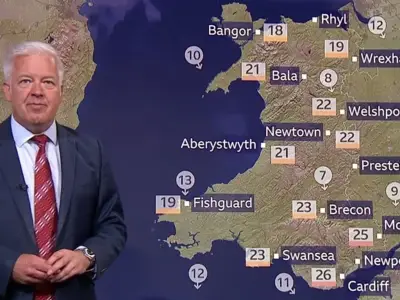
The Met Office has forecast a wall of rain hitting 19 named UK areas from Tuesday, August 25, bringing an end to the recent period of sustained sunny and hot weather. Rainfall rates could exceed 32mm per hour in some spots.
Rain spread from early Tuesday
According to the national weather agency's rainfall radar forecast map, rain clouds will hang over the south and southwest coast of England and up towards Wales from 1am. Southampton, Brighton, and Swindon fall within the affected area, with a build-up in Cornwall towards the southwesternmost tip.
By 4am, a wall of rain extends from Dover into southern Wales via Rochester, London, Reading, Southampton, Swindon, and Yeovil, into Cardiff and beyond, with patches in Scotland and northern England. At 7am, the rain could move into East Anglia and across via Cambridge, Banbury, Birmingham, Swindon, and Hereford, covering much of the southern half of Wales.

Patchy rain and intense downpours
From 10am, rain becomes more patchy, easing in the southernmost parts of England but moving into northern Wales, the Midlands, and patches in Yorkshire and the Humber, the North West and North East of England, parts of Scotland, and the southern half of Northern Ireland. Rain continues from 1pm, moving away from much of Wales but covering parts of the North West, including Manchester, with patches across northern England, some areas of Northern Ireland, and scattered areas across Scotland, including Edinburgh.
At 4pm, patches continue in northern England and parts of Scotland, with rain in southwestern Northern Ireland as a sizeable area moves in from the southern coast of England. More severe rain could begin, including a patch north of Portsmouth seeing more than 32mm per hour. By 7pm, this intense rain covers large areas of southern England, soaking Swindon, Reading, Brighton, Southampton, and Yeovil, with a spear extending through Wales via Hereford and into the Midlands.
Overnight and into Wednesday
Rainfall is expected to range from less than 0.5mm per hour up to over 32mm per hour on Tuesday evening. Heavy rains continue across southern England, Wales, and Scotland by 10pm, with particular intensity in parts of South East England and into the Midlands, east of St Albans, in Kent, and on the Essex coast, including Clacton-on-Sea.
By 1am, rain batters much of Wales again, with similar patterns in parts of Scotland and southwest England, including Plymouth, with rain clouds moving up into the Northwest to cover Manchester. A thick area of rain strikes across the West and East Midlands, with 8 to 16mm per hour in Nottingham. Downpours are anticipated on the southern coast of Scotland, with patches moving southeastward from the southernmost Southern Isles. By 4am, rain eases in various parts of England but hammers areas bordering Wales, which looks almost completely under rain clouds, continuing in parts of northern England and Scotland.
Major towns and cities that could see rain on Tuesday include Brighton, Swindon, Reading, Southampton, Yeovil, Dover, Rochester, London, Cambridge, Banbury, Birmingham, Hereford, Plymouth, Nottingham, Clacton-on-Sea, Newtown, Swansea, Cardiff, and Edinburgh. The list is not exhaustive, and the forecast is regularly updated on the Met Office website.
The Met Office's current outlook for Sunday to Tuesday suggests it will be mostly dry with sunny spells, though cloud and a few showers may affect northern areas. Rain and thundery showers could develop in the south, spreading north later, with temperatures near average. For today, showers are expected to be less frequent and lighter than recent days, though some heavy or thundery downpours remain possible, most likely across Wales, southwestern England, and parts of eastern and southeastern areas. Northern Ireland turns drier later. Tonight, most showers will fade allowing clear spells to develop, with a few persisting around exposed coasts and rather chilly overnight conditions, especially in rural areas. Saturday is expected to see coastal showers gradually easing, leaving most areas dry with sunny spells, though cloud will thicken across northern Scotland bringing some light rain, with temperatures around average after a chilly start.