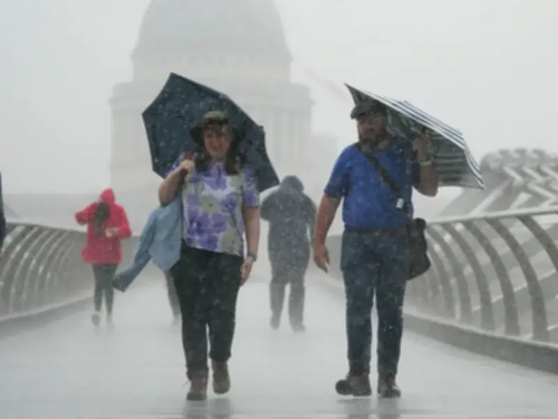
The Met Office has identified 107 areas that are expected to see showers on Monday, as wet weather continues across the UK during the bank holiday weekend. Forecast maps show scattered rain covering much of the nation throughout the day, with the possibility of hail and thunder persisting.
Sunday's wet conditions
Sunday brought heavy and thundery showers in places, affecting festivalgoers. Met Office meteorologist Honor Criswick said: “On Sunday there will be some scattered showers around to start, mostly across Scotland, Northern Ireland might see some.”
“The South East could remain dry, but by the evening they will probably start to see some showers, they also could be heavy and thundery.”

Monday's forecast
Monday is expected to be drier and brighter, but showers are still likely across many areas. According to Met Office weather maps, rain will start around 8am in the South West, with much of Wales also seeing downpours.
By midday, the majority of the rain is concentrated in the North West and North East of England, having slightly dispersed from the South. Areas including Lancaster and Darlington are set to be soaked.
In the afternoon, as far north as Yorkshire will also see some showers, with Scarborough forecast rain at 4pm. Then, as the evening comes in, the rain appears to hit the Midlands with Birmingham, Nottingham and Loughborough experiencing showers at 10pm.
Met Office advice
Criswick added: “It will probably be quite dry first thing on Monday, some showers across western areas, some heavy showers mostly across north Scotland.”
“For many areas it’s going to be turning drier and brighter, a better end to the day compared to the start.”
“On Monday there will be some showers around but probably less heavy thundery ones and a few more brighter spells, it’s still probably worth taking a waterproof if you’re at a festival.”
“Monday will also see maximum temperatures in the early 20s.”
Areas forecast rain on Monday
The full list of areas forecast to see rain includes Looe, Tavistock, Chulmleigh, Dulverton, Minehead, Weymouth, Blandford Forum, Tenterden, Dover, Canterbury, Margate, Bath, Cirencester, Swindon, Didcot, Oxford, High Wycombe, Aylesbury, Chepstow, Llantwit Major, Maesteg, Merthyr Tydfil, Ystradgynlais, Llandeilo, Llandovery, Lampeter, Aberystwyth, Llanidloes, Newtown, Barmouth, Llanwddyn, Welshpool, Church Stretton, Ludlow, Worcester, Wellingborough, Stamford, Peterborough, Norwich, Hunstanton, Skegness, Horncastle, Louth, Caistor, Gainsborough, Mablethorpe, Grimsby, Hull, Hornsea, Driffield, Malton, Bridlington, Pickering, Scarborough, Ripon, Skipton, Burnley, Preston, Settle, Lancaster, High Bentham, Blackpool, Whitby, Ambleside, Broughton In Furness, Brough, Moffat, Langholm, Jedburgh, Hawick, Peebles, Cumnock, Lauder, Biggar, Edinburgh, Cumbernauld, Stirling, Kinross, Perth, Brechin, Glasgow, Aberdeen, Hartlepool, Bradford, Cambridge, Colchester, Brighton, Ipswich, Manchester, Liverpool, Warrington, Leek, Macclesfield, Buxton, Stoke-on-Trent, Uttoxeter, Birmingham, Northampton, Exeter, Milton Keynes, Bournemouth, Nottingham, Grantham, Loughborough, Wolverhampton, Bolton, and Wigan.
Flood alerts and dry conditions
Nine areas were covered by Environment Agency flood alerts, meaning floods are possible, as of Saturday night.
The wet weather comes after continued hot weather across the UK, which coincided with extremely dry conditions. The Met Office has previously said the UK is on course for its hottest summer on record after five heatwaves, with temperatures of up to 38.1C recorded in London.