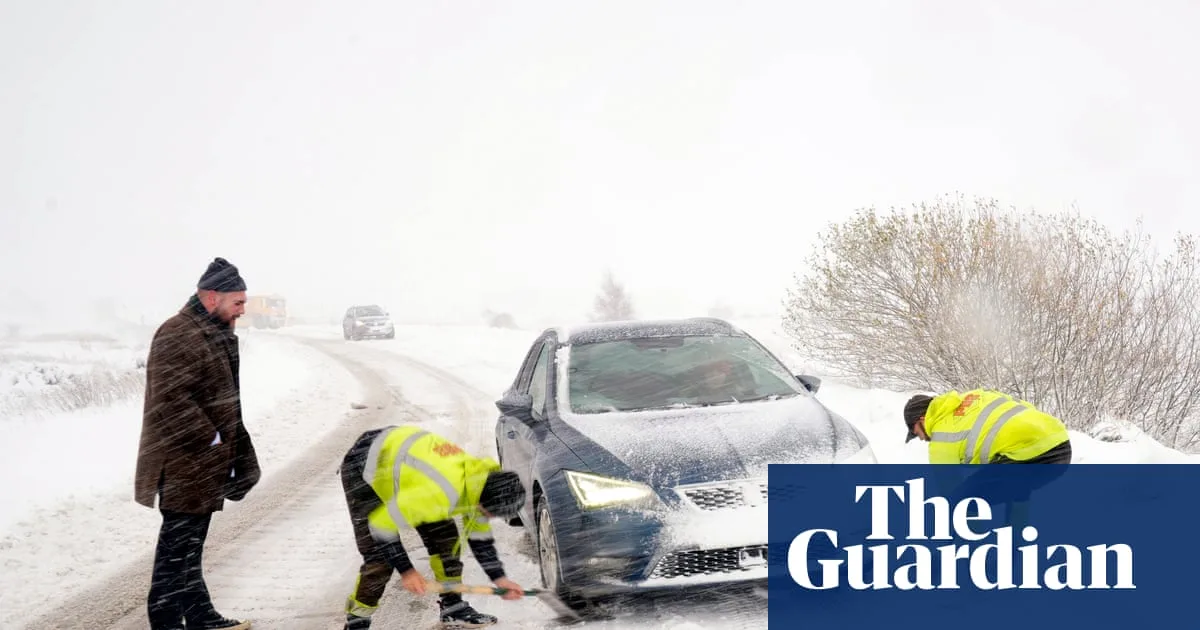
The UK has been hit by its first significant blast of winter, with snow blizzards, ice and freezing temperatures causing widespread disruption. Hundreds of schools were closed and many roads were left blocked or treacherous on Thursday, as the Met Office issued a series of weather warnings.
Eight separate yellow snow and ice warnings were in place for Thursday, covering Devon and Cornwall, parts of Kent, the east coast of England and East Anglia, north-east England, south-west and north-west Wales, Northern Ireland and northern Scotland. A rare amber alert was also in force on the North York Moors and the Yorkshire Wolds, with occasional blizzards and snowfalls of up to 25cm on hills likely to cause substantial disruption.
The snow forced the closure of more than 90 schools in Aberdeenshire, while in Wales 36 schools were shut in Pembrokeshire, 14 in Carmarthenshire and seven in Ceredigion. Around 30 schools in North Yorkshire, eight in East Yorkshire and a handful in Northumberland also did not open. Major roads were affected, including the A1 northbound between Morpeth and Alnwick, which was closed for more than two hours, and the A171, with police advising motorists to avoid Malton, Scarborough, Whitby and Filey.

Temperatures dropped to -6.6C at RAF Benson in Oxfordshire, -6.4C in Sennybridge in Powys and -2.8C at Altnahinch Filters in County Antrim, making it the coldest night of the winter so far. The Met Office said temperatures could fall as low as -10C in rural Scotland on Thursday night. AA patrolman Shaun Jones advised drivers to slow down, saying stopping distances can increase tenfold on icy surfaces.
The Met Office also reported 'thundersnow' had been seen in Aberdeenshire and off the north-east coast, with a risk of more in the same areas. An amber cold health alert from the UK Health Security Agency remains in force across northern England until Saturday morning. Temperatures are expected to rise closer to the seasonal average at the weekend, though conditions will become wetter and windier.
Despite the disruption, some made the most of the snow, taking photographs, building snowmen and sledging. The heavy snowfall also prompted bookmaker William Hill to shorten odds on a White Christmas in the UK, with Aberdeen now at 6/5, Newcastle at 7/4 and London at 7/1.