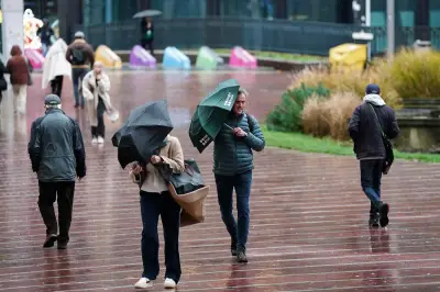
Wales is facing a wet and unsettled start to September, with heavy rain and torrential downpours set to affect parts of the country this week. The Met Office is forecasting a changeable few days, with the worst of the weather expected from Wednesday onwards. Weather maps show the potential for bands of heavy rain to move across Wales on Wednesday morning, with further spells of wet weather continuing into Thursday and Friday.
Monday and Tuesday outlook
Monday will bring showers, with some heavy or thundery downpours possible before conditions gradually improve during the afternoon. Brighter spells are expected to develop as high pressure builds, with temperatures reaching around 21C. Tuesday should start largely dry and bright, but cloud will increase towards lunchtime before showers develop during the afternoon. Some parts of Wales could remain dry, but the more unsettled weather is expected to arrive from Wednesday.
Midweek heavy rain
Wednesday is expected to be the main focus of the wet weather, with a band of heavy rain crossing Wales from west to east in the morning. At 8am on Wednesday, much of North Wales is expected to be experiencing hours of heavy downpours, with heavy rain also forecast for South-West Wales. Thursday could bring another spell of widespread rain, with weather maps also showing significant rainfall continuing across parts of Wales more towards the evening. Heavy rain is forecast in Caernarfon and St Asaph at 8pm on Thursday, with drier conditions expected in the south.

Friday and longer-range forecast
Further wet conditions are possible into Friday, with weather maps showing a band of rain moving across the nation in the late evening. Much of Wales can expect heavy downpours on Friday evening, with the heaviest rain forecast in West Wales and drier conditions expected in the north. The unsettled spell may not end there. The Met Office's longer-range forecast warns that much of the UK could see showers or longer spells of rain between September 5 and 14, with northern and western areas more likely to see frequent rainfall.
Temperatures are expected to remain close to average for early September, although some warmer spells remain possible. Strong and gusty winds could also develop at times, particularly further west and north. The long-range weather forecast for the start of September states: "An unsettled period is likely, with many places seeing showers or longer spells of rain at times. Rain is expected to be most frequent across northern and western areas, while the south and east are more likely to see longer, drier spells."
The forecast adds: "There is also the potential for some strong and gusty winds, particularly in the northwest. Temperatures are likely to be near average, although brief warm or very warm spells are possible, especially in the south."