Greater Manchester is set to be hit with heavy downpours today (October 8) as a 600-mile wall of rain is expected to sweep across the whole of the UK.
The first rain is forecast shortly after 5pm, as the huge weather front moves west-to-east, according to Met Office forecasts. By 6pm, the entire region will be covered in rain.
Overnight downpours and Friday morning easing
Downpours are forecast to continue in Greater Manchester overnight and into Friday morning (October 9), finally easing by around 7.30am. A period of heavier rain is expected to hit the region at around 1am on Friday.
The Met Office's forecast for north west England on Thursday reads: "Turning cloudy into the afternoon from the west, with this thickening before the rain arriving by the evening. Feeling pleasant in the sunshine and light winds initially, but winds picking up later. Maximum temperature 14C."
Friday and weekend outlook
For Thursday evening, the Met Office says it will be cloudy in north west England with "persistent rain tonight, heavy at times into the early hours of Friday".
Friday's forecast for north west England reads: "Rain, sometimes heavy, will clear through Friday morning to become bright with scattered showers. A strong westerly breeze, especially on western hills. Maximum temperature 14C." By Saturday, "scattered showers" will continue, easing throughout the weekend.
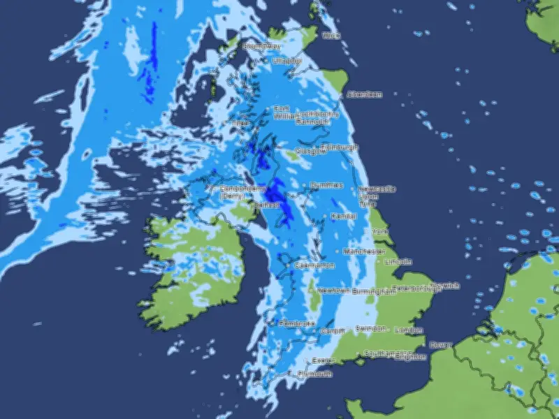
The Met Office's precipitation map shows almost the whole of the UK will be covered in rain.
Long-range forecast into November
Looking ahead at the long-range forecast for the UK, covering October 13 to 22, the Met Office says "changeable" conditions are expected. "Remaining changeable through the middle of October, as a series of low pressure systems run across the North Atlantic, often to the north and northwest of the UK, bringing occasional bands of rain and strong winds, but interspersed with brighter and more showery conditions," the forecast reads.
It continues: "Rain will be most prevalent across hills in the west and especially northwest, where above average rainfall is likely through this period. Longer drier interludes are more favoured in sheltered southern and eastern parts, but even here it is likely to be wetter than during recent weeks."
For the period between October 23 and November 5, the Met Office says the northwest will see "wet and windy" weather. The forecast reads: "The remainder of October and into early November will probably maintain a changeable pattern overall, with areas of low pressure often passing close to the UK from the North Atlantic, interspersed by occasional ridges of high pressure."
"As such, showers or longer spells of rain are likely at times, with the wettest and windiest weather typically in the west and northwest, driest conditions more favoured in sheltered southern and eastern parts. A trend to more widely unsettled conditions is possible into November. Whilst some occasional colder interludes will be possible at times, temperatures are likely to be near or a little above average for the period as a whole."