The Met Office has warned that parts of the UK will see snow, hail and thunder on Saturday, with temperatures feeling significantly colder. Forecasters say there will be “prolonged showers” across England and Wales later in the day, while “sunny spells” are possible for some areas but will be mixed with “heavy” showers, “hail”, “hill snow” and “isolated thunder”.
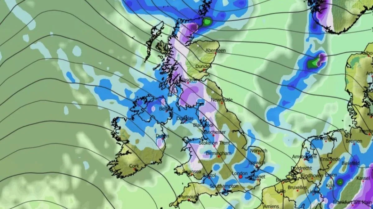
Weather models indicate that 11 cities could be affected by the wintry conditions. At 9am, the GFS model shows light flurries in Northern Ireland, Wales, north-west England and western Scotland. By midday, snow is expected to fall more widely across southern and western Scotland, with further flurries in Wales and north-west England, while rain is predicted for eastern and southern England.
The unsettled weather is set to continue into Sunday, with the Met Office forecasting “wintry showers” and northern gales. Its outlook for Sunday to Tuesday states: “Sunday rain spreads southeastwards. Brighter later with northern gales and wintry showers. Monday mostly dry, cloudier later with increasing winds. Tuesday mild, cloudy with occasional rain; winds stronger.” The BBC forecast also mentions scattered showers that could be “locally thundery” and “wintry” over northern hills.

Looking further ahead, the Met Office has indicated there is a chance of “wintry showers” in April. Its long-range forecast for April 1 to 11 says that while temperatures should remain around average, colder interludes are possible, particularly in the north, where wintry showers could occur at times.