Scientists are warning that the El Niño weather phenomenon is likely to be particularly intense this year, with a 63% chance of sea surface temperatures exceeding 2°C, making it a 'super' El Niño. This natural event, which occurs when Pacific Ocean temperatures rise 0.5°C above normal for several months, will have significant impacts on North America.
One of the earliest effects will be a quieter Atlantic hurricane season between June and November. According to William Baule, an atmospheric sciences researcher at Texas A&M University, El Niño creates unfavourable wind conditions for hurricane development in the Atlantic. The US National Oceanic and Atmospheric Administration (NOAA) forecasts a below-normal season, with up to six hurricanes and 14 storms, compared to an average of seven hurricanes and 14 storms.
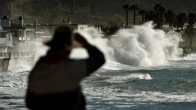
In the southern US, El Niño will bring wetter conditions from autumn, providing drought relief but also increasing the risk of flooding and storms. Atmospheric rivers, ribbons of water vapour, may make landfall more frequently, leading to heavier rainfall and windier conditions, especially along the west coast in winter. Meanwhile, northern states and the Pacific Northwest will experience hotter and drier conditions, with less snowfall in the northern Rockies.

El Niño also enhances the risk of infectious diseases by creating breeding grounds for mosquitoes. During the 2015-2016 super El Niño, outbreaks of West Nile virus, hantavirus, and plague increased in parts of the US. In the Pacific, hurricane activity is expected to increase, impacting western Mexico and possibly Hawaii.
In Canada, impacts typically arrive around the end of the year, resulting in a milder winter, particularly in the western half. The World Meteorological Organization warns that this El Niño will exacerbate global warming effects, including drought, heavy rainfall, and heatwaves. Scientists note that the frequency of strong El Niño events is likely to increase due to climate change.