The Met Office has warned that the El Niño weather pattern could contribute to a weakening of the polar vortex, raising the potential for cold snaps and snow across the UK before the end of the year.
Weather forecasters have indicated that severe wintry conditions could arrive before the year's end as the record-breaking El Niño weather pattern continues to shape the climate.
El Niño and the polar vortex
The Met Office has cautioned that El Niño may contribute to a weakening of the polar vortex, which can subsequently trigger Sudden Stratospheric Warming (SSW). This phenomenon is frequently linked to significant shifts in weather patterns and can heighten the likelihood of cold snaps throughout the UK.
A comparable process was connected to the notorious 'Beast from the East' in 2018, when bitterly cold air and substantial snowfall caused widespread disruption nationwide.
BBC Weather gives verdict on October snow
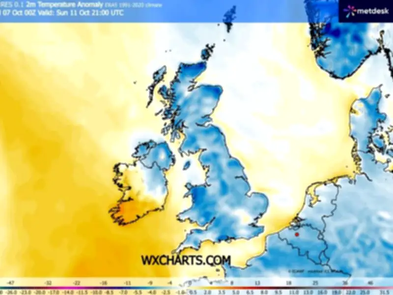
In the nearer term, however, forecasters aren't currently anticipating an early blast of Arctic air this month. Weather models have indicated that some snow could potentially fall across parts of Scotland towards mid-October, especially over higher ground where approximately 5cm (roughly two inches) might accumulate.
While snowfall at higher altitudes isn't uncommon in Scotland during October, it would represent the first notable snowfall of the season and could offer an early glimpse of winter for certain areas, The Mirror reported.
Forecasters at BBC Weather have now released their latest evaluation of whether the UK might experience an early wintry spell this month. Their outlook for October 19 to November 1 indicates that most regions across the country are more likely to enjoy relatively stable conditions rather than a widespread cold snap.
BBC Weather anticipates "drier than normal conditions" across much of the UK, with southern regions particularly likely to record below-average rainfall. Nevertheless, the forecast cautions that "occasional frontal systems" could bring spells of wetter weather to northern areas, with Scotland amongst those most likely to bear the brunt of increased rainfall.
There remains the prospect of some distinctly autumnal conditions, with the forecast noting the potential for "chilly and foggy nights" at certain points. Despite this, temperatures are not presently expected to plummet across the UK. BBC Weather suggests temperatures are more likely to be "close to or a little above normal than below" throughout the period as a whole.
The forecast adds: "There is no sign yet of any set up that might lead to a risk of an early cold Arctic outbreak."
"There is a chance of an alternative outcome where high pressure shifts farther away, allowing low pressure systems closer to the UK, with a wetter and windier but mild outcome."
This indicates that while colder nights and some wintry conditions cannot be entirely ruled out, there is presently little evidence to suggest the kind of sweeping Arctic blast that could trigger significant snowfall and widespread disruption across the nation.
Met Office warns of colder spells
The Met Office is also leaving the door open for a spell of colder weather as October draws on and November edges closer.
Its longer-range forecast notes that "occasional colder interludes will be possible at times", though temperatures on the whole "are likely to be near or a little above average for the period as a whole".
The Met Office forecast, covering October 21 to November 4, indicates that Britain's weather is set to remain unsettled rather than locking into a prolonged wintry spell.
It says: "The remainder of October and into early November will probably maintain a changeable pattern overall, with areas of low pressure often passing close to the UK from the North Atlantic, interspersed by occasional ridges of high pressure."
"As such, showers or longer spells of rain are likely at times, with the wettest and windiest weather typically in the west and northwest, driest conditions more favoured in sheltered southern and eastern parts."
"A trend to more widely unsettled conditions is possible into November."
Could the UK still see a major winter blast?
The latest forecasts therefore give no indication that a repeat of the conditions witnessed during the 2018 'Beast from the East' is on the horizon. Nevertheless, the broader weather pattern could still shift considerably as the months progress.
The Met Office has previously drawn attention to the potential impact of El Niño on the polar vortex, with any weakening of the vortex having the capacity to contribute to Sudden Stratospheric Warming. SSW events have the potential to disturb the circulation of cold air around the Arctic and, depending on how the atmosphere reacts, can raise the likelihood of colder conditions pushing down towards lower latitudes.
This does not guarantee a significant snow event, and any possible impact on the UK would hinge on how atmospheric conditions develop at the time.
For the time being, the most recent forecasts point towards a largely mild and unsettled close to October, with particularly wet and blustery spells expected across northern and western parts of the country. Elevated areas of Scotland could still experience some early-season snowfall, however forecasters are not currently identifying a definitive signal for a widespread Arctic cold snap across the UK this month.